Available now · PSTM · gathers & velocities · AVO attributes
NPRA Reprocessing Library
Revitalized vintage 2D seismic for evaluating the National Petroleum Reserve–Alaska — the regional framework across most of the Reserve, in modern form.
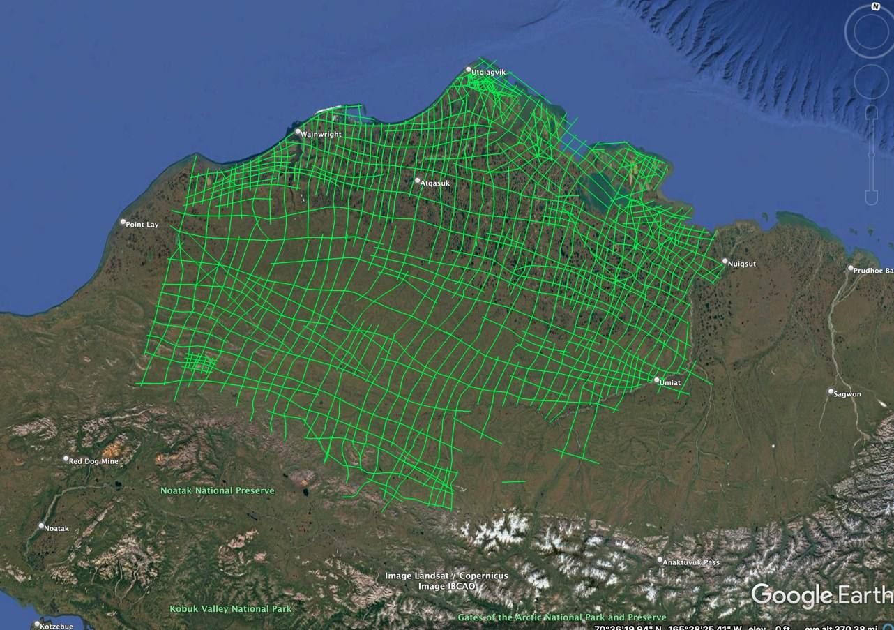
Available now · PSTM · gathers & velocities · AVO attributes
Revitalized vintage 2D seismic for evaluating the National Petroleum Reserve–Alaska — the regional framework across most of the Reserve, in modern form.
The March 18, 2026 NPR-A lease sale drew $163.7 million in high bids on 1.33 million acres from 11 bidding companies, and further NPR-A sales are scheduled over the coming decade.
The 1970s–80s Navy/USGS 2D grid is still the regional framework across most of the Reserve. Bidders and new leaseholders need it in modern form.
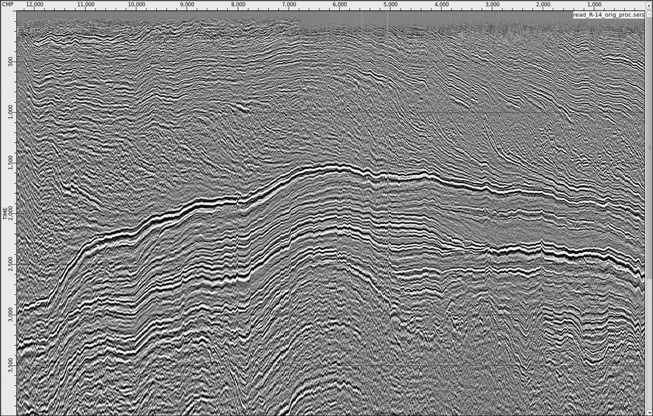
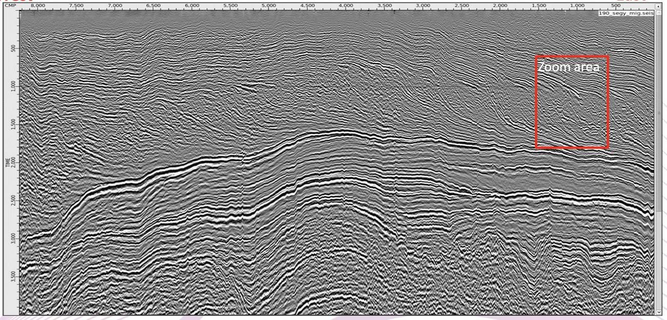
Nine seasons of mixed crews, 48- and 96-channel spreads and 55–330 ft group intervals, brought to a common sequence, datum and phase — so lines tie to each other and to wells. Regional transects such as R-14 cross the Reserve end to end (~250 miles).
No field-tape retrieval, no processing queue, no QC cycle between you and a bid date.
Built once over eight years and shared across licensees.
Review the actual lines over your area on screen first.
Many vintages on one sequence. A single reprocessed survey won't tie to its neighbours.
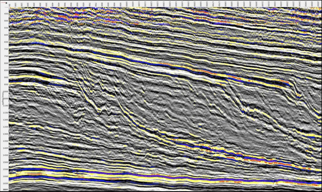
Drag across the section to compare. Shallow noise removed and Nanushuk reflectors restored by pre-stack migration.
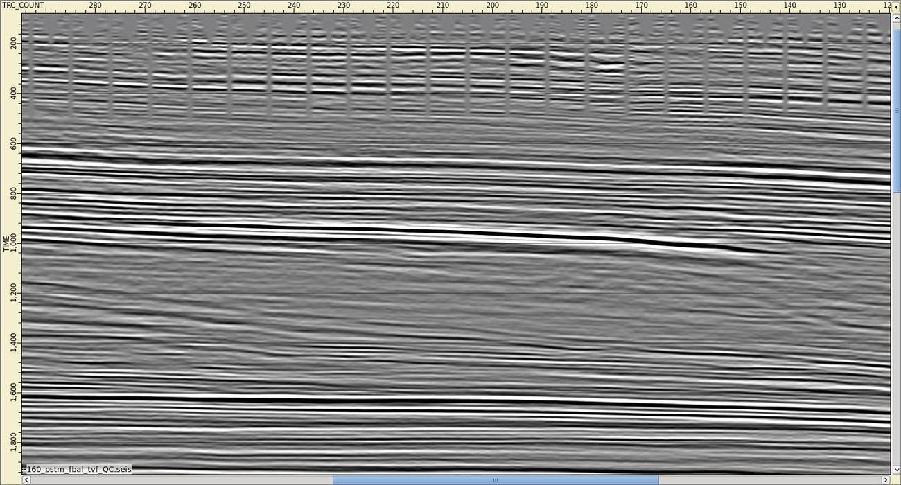
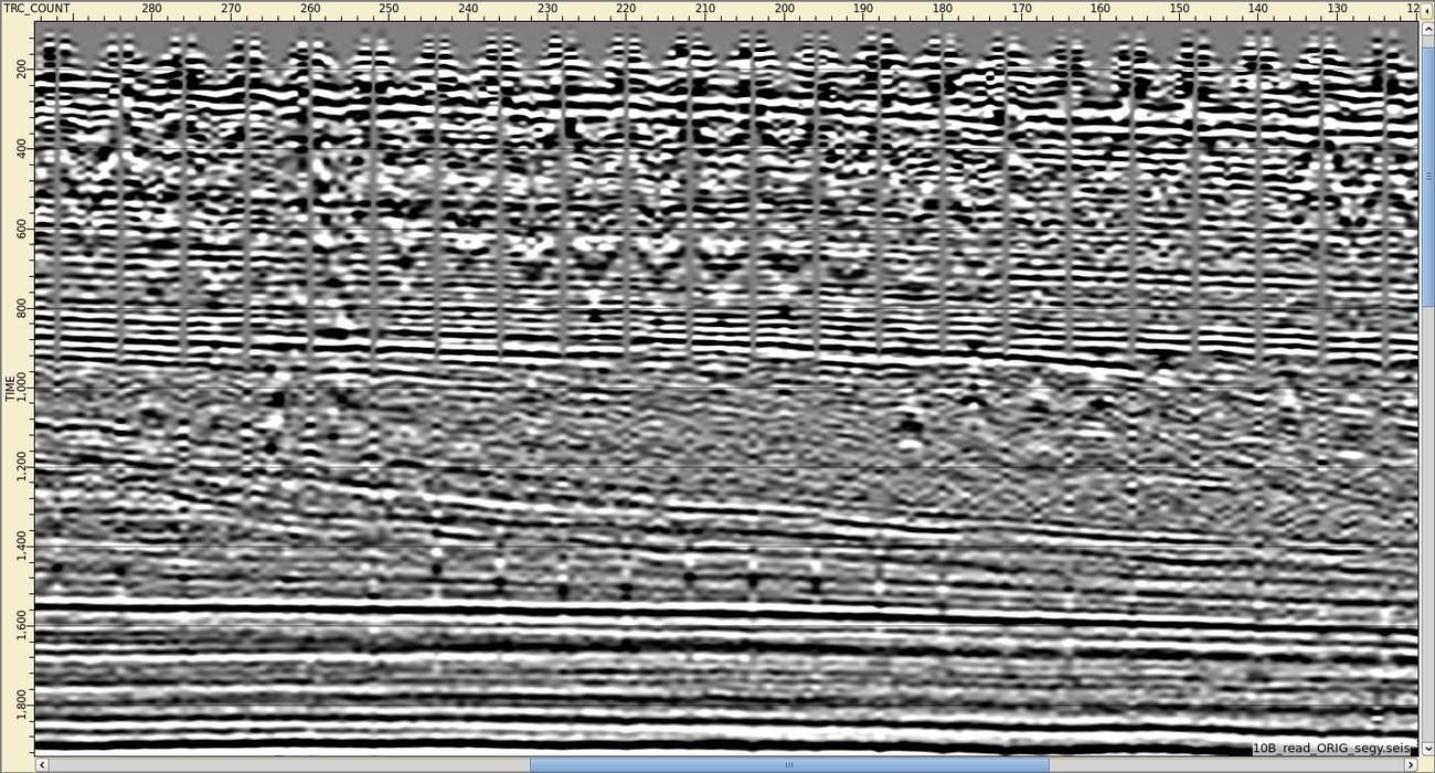 Before · GSI final stack, 1974After · 3D Imaging Technology, 2022
Full-library package and per-mile pricing on request.
3D Imaging Technology, LLC — processing. 40+ years in seismic processing (Digicon, Kelman).
Seismic Utensils — AVO and attribute analysis.
Seismic Strategies LLC — regional seismic business development, sales and licensing; initiated the NPRA program in 2017.
A 45-minute walk-through of the lines over your area with our processor.
We map lines to your leases, bid areas or farm-in targets and quote.
Non-exclusive license; delivery in SEG-Y when you're ready.
Speculative data product. The reprocessed data are licensed non-exclusively by 3D Imaging Technology, LLC; purchase and licensing follow standard EnerGeo Alliance (formerly IAGC) terms. Displays on this page are reduced, display-only examples.